Calculation of the UV-Cloud modification factor (CMF) bases on a transformation of the SOL-CMF following the algorithmus of den Outer et al. (2005).
This algorithm is also the basis for the calculation of the COST UV-Index Climatology.
Transformation SOL-CMF --> CMFUV:
CMFUV=(1-exp(-0.23*ln(1+Pfac*SOL-CMF)))/(1-exp(-0.23*ln(1+Pfac)))
where
Cos(SZAmin) | Pfac
-----------------------------
0.00 - 0.15 | 6.12888
0.15 - 0.30 | 4.40254
0.30 - 0.45 | 3.03030
0.45 - 0.60 | 1.93951
0.60 - 0.75 | 1.07246
0.75 - 1.00 | 0.38325
where
SZAmin = Minimal Solar Zentih Angle for day.
The plot below shows the relation between CMF(global solar) and CMF(UV erythema) depending on solar zenith angle.
Relation: CMF (solar) versus CMF(UV erythema)

At the end of this page you can find download of this climatology.
Monthly averages
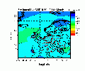
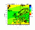
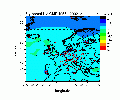
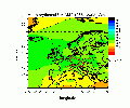
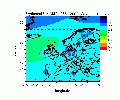
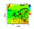
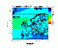
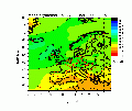
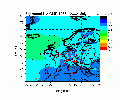
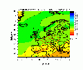
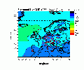
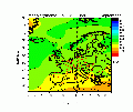
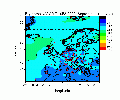
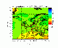
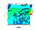
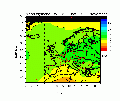
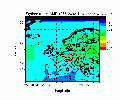
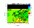
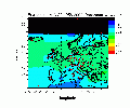
Below you can find graphics (left side) of averaged erythemal UV Cloud Modification Factor for each month of the year.
Monthly averages are calculated from the years 1958 to 2002 from daily values.
On the right side the corresponding accuracy is shown. The accuracy of monthly averages depends on the density of stations.
Calculations and graphics were provided by: H. Staiger.
| JANUARY | FEBRUARY | ||
Average
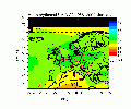 |
Accuracy
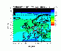 |
Average
 |
Accuracy
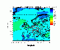 |
| March | APRIL | ||
Average
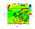 |
Accuracy
 |
Average
 |
Accuracy
 |
| MAY | JUNE | ||
Average
 |
Accuracy
 |
Average
 |
Accuracy
 |
| JULY | AUGUST | ||
Average
 |
Accuracy
 |
Average
 |
Accuracy
 |
| SEPTEMBER | OCTOBER | ||
Average
 |
Accuracy
 |
Average
 |
Accuracy
 |
| NOVEMBER | DECEMBER | ||
Average
 |
Accuracy
 |
Average
 |
Accuracy
 |
Download and data information
Data format:
The files (*.txt) contain yearly gridded (1x1 degrees in latitude and
longitude) daily (or monthly) Cloud Modification Factors for UV (CMFUV) calculated based on the solar cloud modification factors
from Henning Staiger.
The file format is exactly the same as the original files:
similar to the format of total ozone files
i.e. the grid dimensions are
61x50 covering longitudes 25W-35E and latitudes 80N-31N in
a regular lat-lon grid with 1 degree spacing. See the total ozone
readme file for details. Column delimiter is one blank space, record
delimiter is carriage return + line feed.
Usage
Non-commercial:
This climatology is free for non-comercial use.
In any application aknowledgement has to be given to the Action COST726 (www.cost726.org)
and to H. Staiger.
In case of publication additional reference 1 (see below) has to be citated.
In any other case:
you have to contact the developer: H. Staiger
Download monthly averages (*.zip):
Download monthly accuracy (*.zip):
Download daily data by period (*.zip):
Download daily data by year (*.txt, 7.9 MB each year)
References: Last Update: March 2009,
1958-2004 (2.6 MB)
1958-2004 (2.0 MB)
1958-1970(21.5)MB
1971-1980(16.5 MB)
1981-1993(21.5 MB)
1994-2002(14 MB)
2002-2004 (3 MB)
----
----
----
----
----
----
----
----
1958
1959
1960
1961
1962
1963
1964
1965
1966
1967
1968
1969
1970
1971
1972
1973
1974
1975
1976
1977
1978
1979
1980
1981
1982
1983
1984
1985
1986
1987
1988
1989
1990
1991
1992
1993
1994
1995
1996
1997
1998
1999
2000
2001
2002
2003
2004
----
----
----
----
----
Den Outer, P. N., Slaper, H., and Tax, R. B. (2005)
UV radiation in the Netherlands. Assessing long-term variability and trends in relation to ozone and clouds,
J. Geophys. Res., 110, D02203, 1-11, doi: 10.1029/2004JD004824.
by A.W.Schmalwieser